About Newberry Springs
DiscoverNewberrySprings.com is brought to you by the Newberry Springs Chamber of Commerce. Learn more about the Chamber on the Contact page.
Written by Cliff Bandringa
So, you want to learn more about what Newberry Springs is all about? Well, you’ve come to the right page as it explains what type of weather to expect throughout the year, the types of geology and landscapes you’ll see, and a little bit of history.
This page summarizes the history of Newberry Springs. See the Newberry Springs History page for a deeper dive into the area’s history.
NOTE
In This Article
- Environment
- Geography & Geology
- Human History
- Wildlife & Plant Life
- Transportation
- Homesteading
- Mining
- Water
- Today
Environment
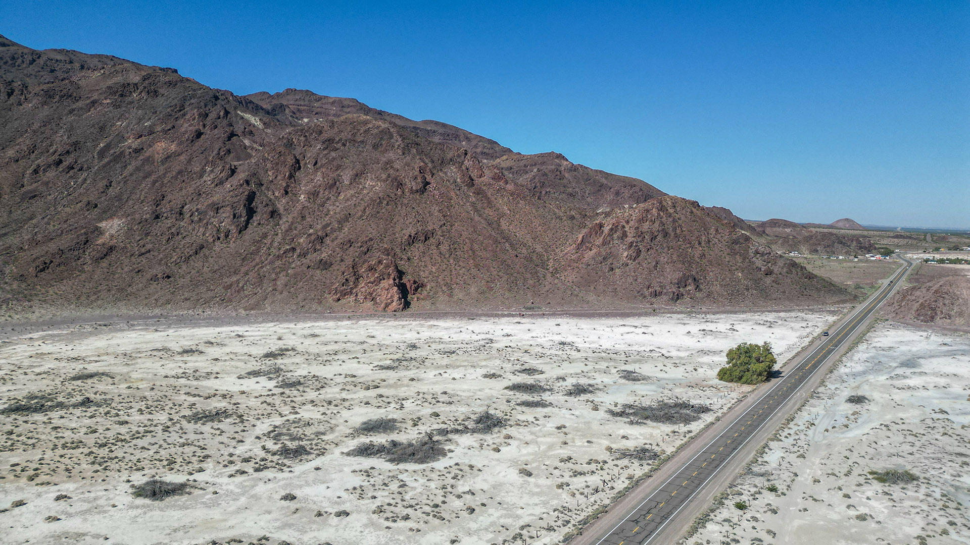
As you may already know, Newberry Springs is situated in the south-central Mojave Desert. Its elevation ranges from about 1,800 feet above sea level at the Mojave River, 1,900 feet along Route 66 and the townsite of Newberry Springs itself, to about 4,600 feet at nearby Newberry Mountain.
Being considerably inland from the ocean, Newberry Springs is drier than the southern areas of the Mojave Desert. It’s also considerably lower in elevation than other areas, making it slightly warmer. The lower elevation is also the reason why many of the Mojave Desert’s iconic flora, such as the Joshua Tree, does not grow here.
Geography & Geology
Newberry Springs sits in a large desert valley that was formed by the Mojave River. It was earlier filled by an ancient lake named Lake Manix that existed over 20,000 years ago when the environment was much cooler. Close to the river and where the lake used to exist are numerous small sand dune fields. The valley is surrounded on three sides by rugged desert mountains. The mountain ranges immediately to the south are higher and more rugged and are the home to two volcanic areas.
Thanks to the Mojave River, ancient Lake Manix, and water runoff from the surrounding mountains, the areas east and north of Newberry Springs were often rare desert swamps filled with shallow water. This is what would end up attracting people to Newberry Springs. Due to human development over the past 40-60 years, that water has diminished, and the swamps only reappear after periods of wet weather.

As seen from the map above, most of Newberry Springs sits inside what used to be covered by Lake Manix. According to geologists, the lake drained rapidly following an earthquake, landslide or other event, creating modern-day Afton Canyon.
The valleys and mountains are part of the geologic Basin and Range Province. This means that they were slowly created over the last 20 million years from the extension or spreading of the Earth’s crust. Most of the valleys and mountains in the Basin and Range, such as in Nevada, trend north-south. In the Mojave Desert, however, they trend in more random directions.
Human History
The history in this area begins with nomadic Native Americans that lived in this area during cooler periods. Like many nomadic tribes in the Southwest, they immigrated back and forth to favorable living conditions throughout the year, such as traveling to higher elevations in the summer, and lower elevations throughout the Mojave Desert in the winter.
Unlike other parts of the Mojave Desert, Newberry Springs offered a valuable commodity – water. This included the waters of Lake Manix and, later, Troy (Dry) Lake. Water attracted many of the very early Native Americans to this area. Evidence of their existence has been found throughout the valley as exhibited at the Calico Early Man Site. Later, the abundance of water also routed early travelers through Newberry Springs that traded goods with distant tribes in Arizona and the California coast.
Wildlife & Plant Life
Situated in the Mojave Desert, much of the wildlife found in and around Newberry Springs is like other nearby places, such as the Mojave National Preserve and Death Valley National Park. This includes birds, lizards, snakes, desert tortoise, coyote, bighorn sheep, and many others. The plant life you’ll see is also similar, such as creosote, shrubs, and various cacti.
Just south of Newberry Springs are two wilderness areas: Newberry Mountains Wilderness and Rodman Mountain Wilderness Areas. Both have similar terrain, including colorful rocky peaks, maze-like canyons, and alluvial washes. They are great examples of mountain ranges typical of the Mojave Desert.
The Newberry Mountains stand out with their vibrant, purplish hues, reminiscent of the Calico Mountains, while the Rodman Mountains are less colorful, characterized instead by a vast basalt flow formed by the Malpais cinder cone. Both wilderness areas are accessible via the Rodman Mountains Dirt Road Adventure tour route, which offers a scenic journey through these rugged landscapes. Along the way, you’ll encounter a variety of wildlife and plant life, as described below. During the spring months, the washes draining these mountains come alive with an abundance of plants, including a stunning display of wildflowers.
Wildlife: Bighorn Sheep
The rocky portions of these two mountain ranges are often populated with herds of bighorn sheep. This species of mountain sheep is found in mountainous regions of the Mojave Desert, including California, Arizona, Nevada and Utah. They all look and behave identically. Some herds were established by wildlife agencies after the original indigenous herds went extinct.
Bighorn sheep are commonly spotted in Newberry Springs Park (on the very south end of Newberry Road – see Newberry Springs video tour) as herds come down to eat grass and drink water. This commonly occurs during sunset hours. Inquire locally about more information about spotting bighorn sheep.


Wildlife: Desert Tortoise
The desert tortoise (Gopherus agassizii) is well adapted to survival in the harsh environment of the Mojave Desert. Often living for more than 80 years, this reptile makes the most of limited food and water resources. They can be randomly spotted throughout the area covered in this guide, usually in lowlands (not mountainous areas), and away from populated areas.
When driving on any road, mainly dirt roads, around Newberry Springs, always be on the lookout for a tortoise that may be in the road. From a distance, they commonly look like a rock. When you approach them at speed, it may be too late to steer away to avoid running them over.
Tortoises hatch from small, ping-pong ball sized eggs that are laid in burrows. Tortoises become mature at about 15 years old. They have few predators once they reach adulthood but when they are young, they are small and have soft shells. This makes them easy prey to ravens, coyotes, roadrunners and other animals.
Although you can encounter a tortoise in any sandy area of the Preserve, be particularly careful as you drive the paved or dirt roads. They move very slowly and are easily run over. If you come across a tortoise, do not touch or handle it in any way, unless to get it out of harm’s way. Not only is it illegal to touch, harm, harass or collect a wild tortoise, it is just not good for them in many ways. Tortoises are very prone to catching diseases that we humans or our pets may carry.
Touching or “handling” a wild tortoise will cause it to become defensive. One way it protects itself is to pull its head and legs into the protective shell but another way is to empty its bladder. If this happens at a dry period and the tortoise cannot replenish that lost water, it will die. If you are privileged enough to see a tortoise in the wild, just stand back and observe it (or photograph it) from a reasonable distance.


Wildlife: Birds
Because of the combination of nearby mountains, broad valleys and small wetlands, Newberry Springs offers a variety of habitats for birds. The mountains attract large raptors like the golden eagle, where the many ponds of Newberry Springs attract an array of migratory birds that rest here while crossing the vast desert.
The most common bird encountered is the raven. Ravens are the largest member of the Crow family and the Common Raven (Corvus corax) is the species found all across the northern hemisphere including the Mojave Desert. The brain size of a Common Raven is one of the largest of any bird species and they have the ability to “problem solve”. They also have a wide range of vocalizations and can mimic sounds in their environment including human speech. The lifespan for these birds in the wild is 10-15 years.
Another fairly common bird that is often mistaken for a raven or an eagle is a turkey vulture. It can be found throughout the Americas. Like Ravens, turkey vultures are large, dark-colored birds. Turkey vultures are seen around Newberry Springs in the fall to winter months because of their migration. They are scavengers and feed almost exclusively in carrion (dead animals). They have keen vision and a sense of smell that they use to fly low and catch the scent of decaying animals. They’re very awkward on land but graceful in flight as they effortlessly ride the circling thermal pockets of air without ever flapping a wing.
Plants: Brittlebush
These highly successful plants are found all over the Southwest. They can easily be spotted all around Newberry Springs and the surrounding rocky slopes. In spring, brittlebush are prolific bloomers putting out bright yellow daisy-like flowers. Brittlebush appears as round bushes about 1-4 feet (30 cm to 1.3 m) tall and wide (across).
During rainy and cooler months, it grows large, bluish-green and hairless leaves. As moisture becomes scarce towards the summer months, the plant drops these bigger leaves and grows smaller and thicker leaves with hairs that help to deflect the sun’s heat which cools the plant and conserves valuable moisture.


Plants: Creosote
By far, the creosote bush is the most common plant life found around Newberry Springs and all of the Mojave Desert. When you enjoy any desert vista around Newberry Springs, chances are that the most prominent plant or bush in the foreground will be creosote.
Creosote is a unique bush. Knowing more about this uniqueness will help you enjoy it even more during your visit to Newberry Springs. The plant is very adapted to the desert environment, with its small, waxy and dark green leaves being well adapted to protecting itself from the harsh desert sun.
In flat regions around Newberry Springs, you can easily see how creosotes are evenly spaced apart from each other. This is because the roots of the creosote plant puts out a compound that keeps the roots of neighboring creosote bushes away so that each bush has its “territory”. The roots of creosotes are known to go down great distances, up to 50 feet (15 m) deep, in search of water. When inside washes that drain the various mountains surrounding Newberry Springs, creosote is also very common but doesn’t always grow evenly spaced apart.
Recently, there has been much debate about whether or not the creosote bush is the oldest living plant on Earth. In the botany community, it has long been accepted that Bristlecone Pine trees (Pinus longaeva) were the oldest living organisms on Earth – the oldest being about 4,600 years old. A new theory says that, because cloned plants are of the same cells as the original plant, they are, in fact, part of the original plant. Creosote bushes often reproduce by cloning and their offspring are found in rings around the original plant. Some of these creosote “cloning rings” have been found to be more than 11,000 years old. Some of the oldest creosote cloning rings have been found in the Lucerne Valley, which is the next big valley to the south of Newberry Springs. One such ring, that was spotted from an airplane, is known as “King Clone” and is 75 feet (22 m) in diameter.


Plants: Cactus
There are many varieties of what people normally consider “cactus”, even though some plants that are considered cactus are really not, such as yucca. Plants belonging to the cactus (Cactaceae) family can occasionally be spotted on the valley floor of Newberry Springs. However, these plants are more abundant in ideal growing conditions such as on rocky outcroppings, washes and alluvial fans, and inside rugged mountain canyons, such as the aforementioned wilderness areas.
Members of the Cactaceae family found here include:
- Barrel cactus that are part of the Ferocactus family;
- Multi-headed barrels, part of the Echinocactus family;
- Small columnar cacti of the Echinocereus family;
- And prickly pear, cholla, jumping cactus and beavertail, all part of the Opuntia family.
Many of these cacti are found in the Newberry and Rodman Mountains, as well as the Calico Mountains. See the following tours that will lead you into the places where these plants can be found:
- Calico Mountains Dirt Road Trip
- Pyramid Canyon Hike
- Rodman Mountains Dirt Road Adventure
- Sunrise Canyon Hike
Many people consider the yucca plant a cactus, but they’re not. The famous Joshua tree found throughout the Mojave Desert at certain elevations is part of the yucca family. Joshua trees are not found in Newberry Springs, other than in someone’s yard that was transplanted from somewhere else. The yucca that will be seen around Newberry Springs is the Mojave yucca and sometimes the banana yucca.
Below are examples of various cacti that will be found in the Newberry Springs area.


Summary
There’s a lot to cover when it comes to plants that live in the Mojave Desert. These explanations above merely scratch the surface. We recommend purchasing any number of books and guides on plants and cactus of the Mojave Desert.
The growing conditions found in the Mojave National Preserve is like Newberry Springs. The on-line guide below includes a comprehensive botanical guide to plants, shrubs and cacti found here.
Learn More?
Transportation
As European settlers moved west through this area, they used the same routes that were trailblazed by the Native Americans. Some of the Natives were hired as guides to lead early pioneers across the vast desert. As more pioneers moved west, consistent trails were established that, over a century later, are roughly followed by modern-day Interstates 15 and 40.
One route in particular crossed the desert by passing by various springs for water. One of the biggest sources of reliable water was Newberry Springs. By 1880, a railroad (originally the Atlantic and Pacific Railroad) followed this route from Barstow to Needles. This was the first route offering “mechanized” travel.
A few decades later, by 1910, the advent of the automobile ushered in the development of what became known as the National Old Trails Road that followed the railroad line. In 1926, this would become the famous Route 66. Both historic Route 66 and the now BNSF Railway follow each other as the cross the Mojave Desert.
Homesteading
The Homesteading Act that began in 1862 saw interest in the lands around Newberry Springs in the 1930s during the Great Depression. A new breed of settlers laid down roots in what is now Newberry Springs, with its abundance in water, free land, and easy access to transportation with Route 66 and the railroad. Many people quickly learned how to live in the desert, which was quite different from where they came from.
After World War 2 the economy improved significantly and many of the homesteaders left the desert area and moved to areas, such as Los Angeles, to live an easier, more modern life. This left many old and abandoned buildings in and around Newberry Springs, some of which can still be seen today, but most are now gone.
Mining
Between 1920 and 1960, the economy around Newberry Springs was heavily driven by the mining industry. The surrounding mountains contained a multitude of valuable ores, not just gold and silver, but minerals that were needed to create modern-day electronics, fertilizers needed in agriculture, ceramics, and so many other products. Now, only the ruins of those mines exist due to less demand and lessor expensive sources such as from overseas.
Water
Always the lifeblood of Newberry Springs or any desert community, water was abundantly available until the 1980s. By then, human development literally “sucked” the water out of the Mojave River many miles upriver. Communities closer to the L.A. Basin, such as Apple Valley and Victorville, swelled in population between 1980 and 2000. The population of the Victor Valley in 1980 was roughly 50,000, and in 2020 it exceeded 500,000.
In the 1980s, communities downriver from the Victor Valley demanded that something be done. The newly formed Mojave Water Agency, which is associated with the California Aqueduct, built a separate aqueduct from Hesperia to Barstow and Newberry Springs. This would allow water from the California Aqueduct to be delivered to places further down the Mojave River to replenish their depleting groundwater.
- Be certain to read about Water & the Mojave River on the Newberry Springs History page
Today
Over the past 40 years, Newberry Springs has attracted desert dwellers to this unique way of life. Farmers were able to utilize the water to grow crops that thrive in the dry desert environment including alfalfa and pistachios. Water sports enthusiasts, such as water skiers, developed communities that centered around a lake especially designed for water skiing. Off-road enthusiasts come to the deserts and mountains around Newberry Springs to enjoy endless off-highway exploration.