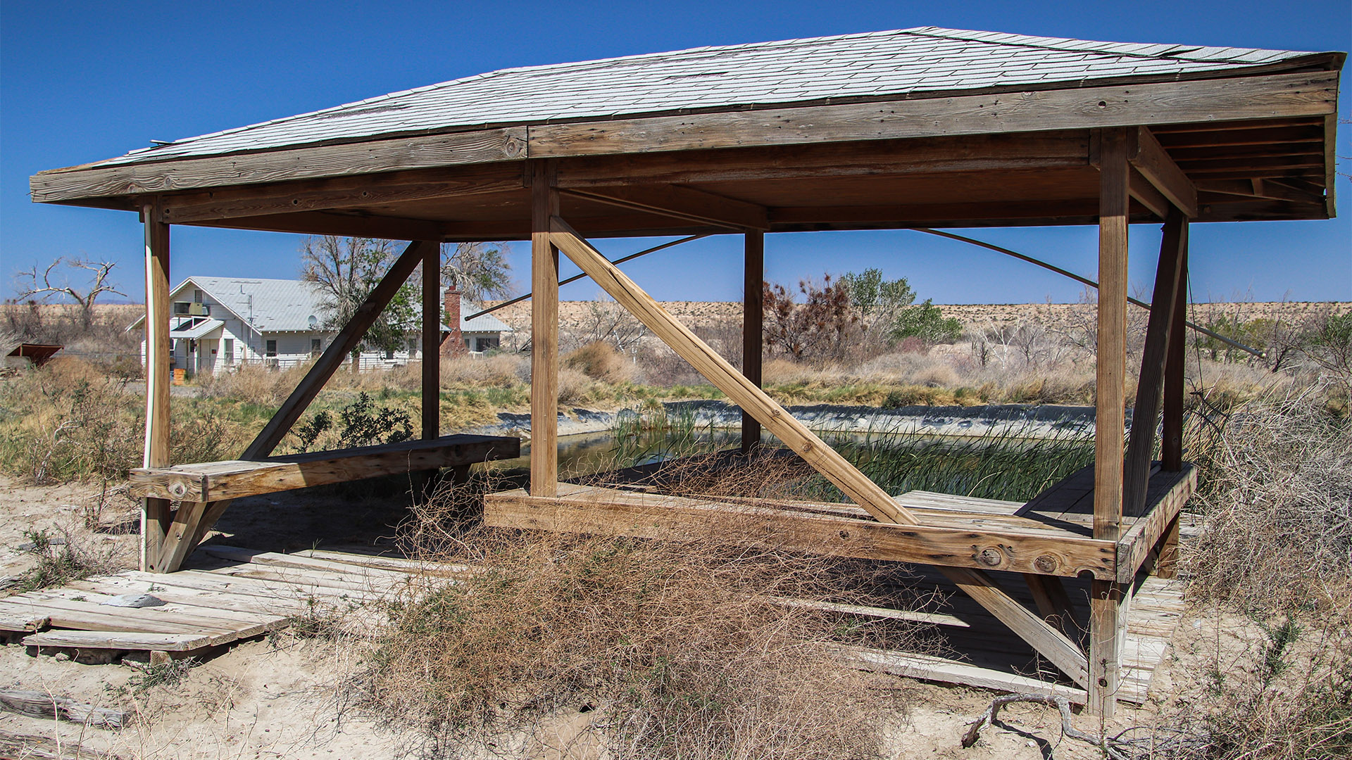
Camp Cady
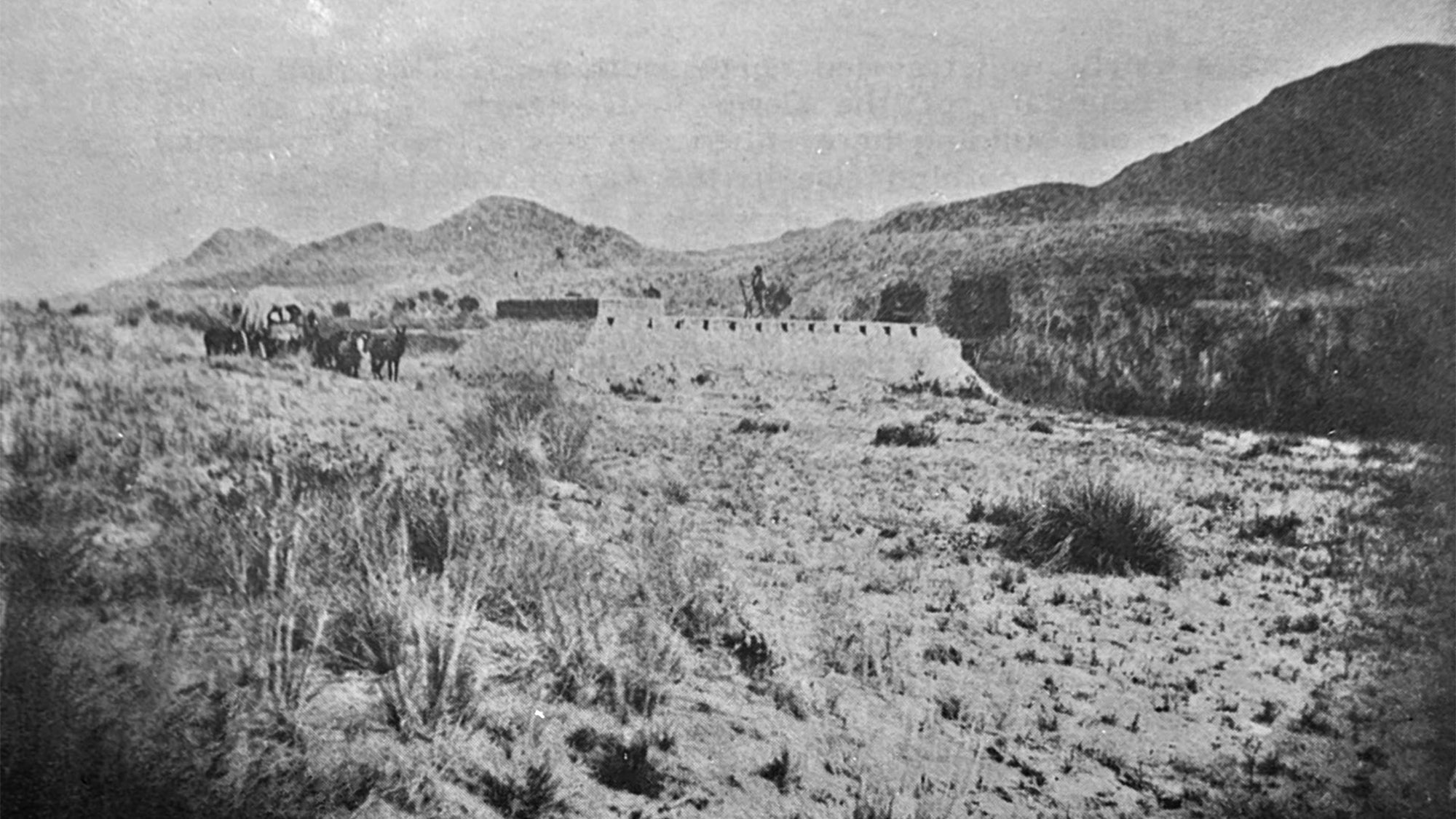
Long before the first Caucasian settlers in the Newberry Springs area arrived, a small fort was established in 1860 to defend wagons traveling a series of historic roads from attacks by Native Americans. Camp Cady was short-lived after the aggressions were subdued. The grounds around the camp would later become a ranch, renamed Camp Cady Ranch, and later still, became a California State-run wildlife area of the same name.
Today, Camp Cady is a nice tranquil desert-riparian area along the Mojave River. Although it’s a wildlife reserve, the area is popular with small-game (dove and quail) hunters, birdwatchers and is open to hiking. The area is administered by the California Department of Fish and Wildlife. Buildings from the former ranch are still maintained and used by Fish and Wildlife staff. There is usually a caretaker living in one of the buildings.
Written by Cliff Bandringa & John Wease
History
Beginning with the Native Americans, long before the 1800s, trade routes were established where tribes from Arizona would trade with other tribes along the California coast. That would mean they had to cross the long, formidable expanse of the Mojave Desert between the Colorado River and the Coastal Mountains. These Native Americans became experts on how to navigate through this desert, going from spring to spring that held the lifeblood of survival – water.
When the first Caucasian explorers came to this region in the late 1700s, they hired these experts to help them navigate across the Mojave Desert. Later, in the 1840s, various wagon roads were established. One, named the Old Spanish Trail, came from Santa Fe, New Mexico, and headed to Los Angeles, that swung way to the north into Utah to avoid the brutal Apache tribes in Arizona, then down into Southern California roughly following today’s I-15. Another, named the Old Government Road or later known as the Mojave Road in later years, came from Arizona’s territorial capital in Prescott and also headed to Los Angeles. A third, called the Mormon Road, came from Salt Lake City, joined up with the Old Spanish Trail near Cedar City, Utah, and again headed into the Los Angeles basin.
Beginning in the 1840s, with the increase of Caucasian travelers, the various Native American tribes, such as the Mojaves, Paiutes and Chemehuevi, were generally mistreated by these travelers, leading to aggressions. By the 1850s, Native Americans were organizing raids on the wagon and pack trains on these roads. These attacks were not ignored and soon the U.S. Army was called in to defend and protect these roads.
In 1859, the Mojaves were “subdued”, and Fort Mojave was established in the town of the same name today, halfway between Needles, California, and Laughlin, Nevada. To supply Fort Mojave, supplies had to be brought in from Los Angeles using the Old Government Road. Those wagon trains needed supplies and needed to be protected from potential raids from Native Americans. So, a series of “redoubts” were planned along the route, each being a “days ride” apart. To keep a supply of water, redoubts were built next to springs; the same springs that Native Americans would use to hop-scotch between during their desert travels.
Camp Cady would be the first redoubt to be built in 1860. However, it closed the following year because of the Civil War. During the war, it was manned periodically by California Volunteers. After the war, it reopened and resumed helping with the supply line to Fort Mojave. The other redoubts that were planned were also built. They were named Fort Piute, Camp Rock Spring, and Camp Meryl Springs. Soda Springs, which is now known as Zzyzx, was also used as a camp.
In 1868, the camp was moved about a half mile upriver and more substantial buildings were built. These buildings and the new location would be the precursor to Fort Cady’s next chapter.
Camp Cady Becomes Camp Cady Ranch
After the military stopped using these redoubts around 1871, individuals took over these establishments and turned them into private enterprises. The same thing happened to the other redoubts. Meryl Springs became a hotel and tavern along the Mojave Road. Camp Rock became a major water source for ranchers in Lanfair Valley. Although Fort Piute was totally abandoned and not used, a historical society has restored the redoubt to match the floorplan it once had.
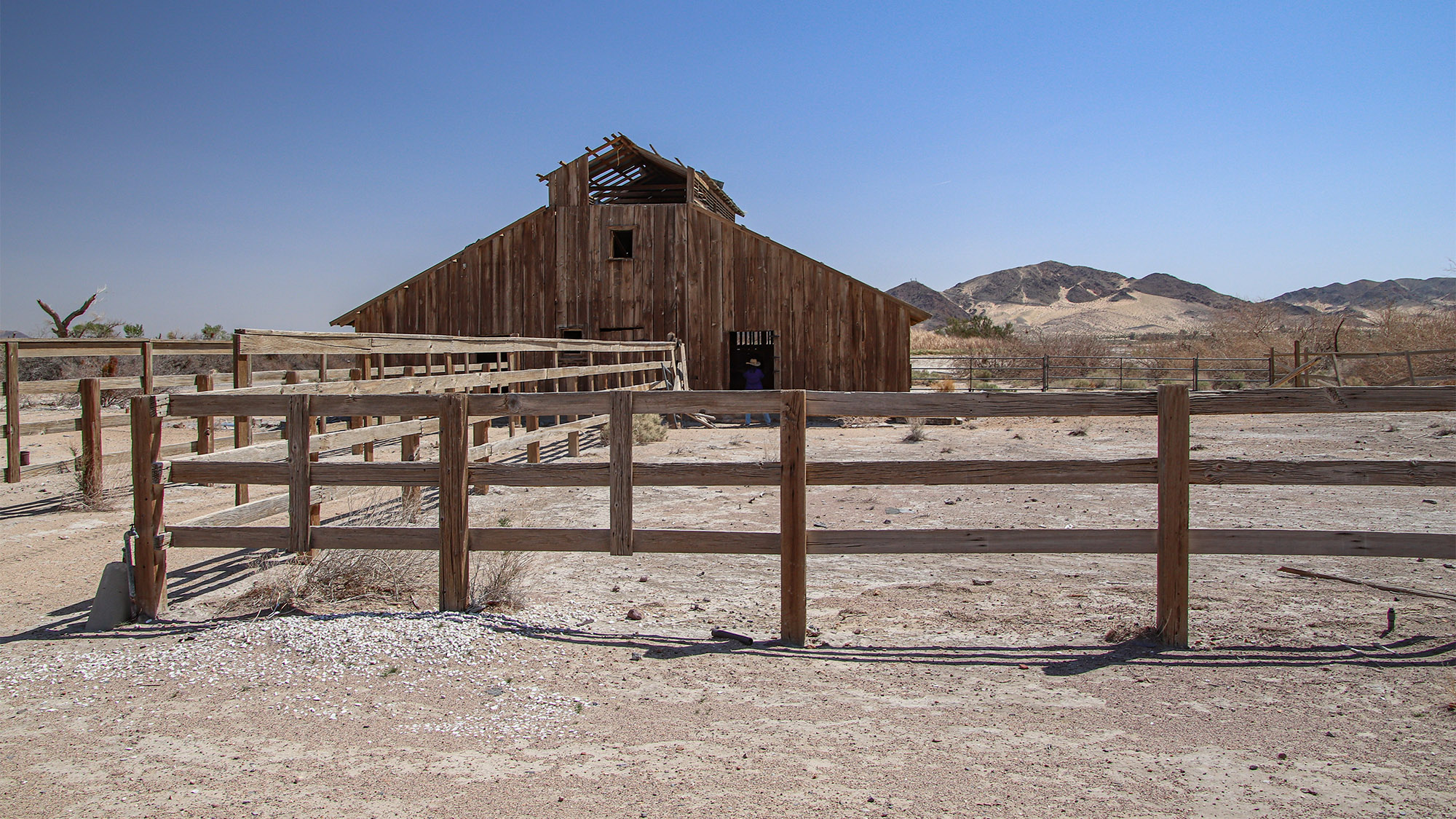
The four-square mile property was sold to a Mr. Cantwell and Mr. Winters. In 1889, a five-stamp mill was built at Camp Cady to process gold ore from the nearby Alvord Mine. In 1930, Mrs. Mintie James and Mrs. Melville bought the property to use as a cattle ranch. This is when the buildings and barn seen today at Camp Cady were built. The property was acquired by the California Department of Fish and Wildlife around 1980.
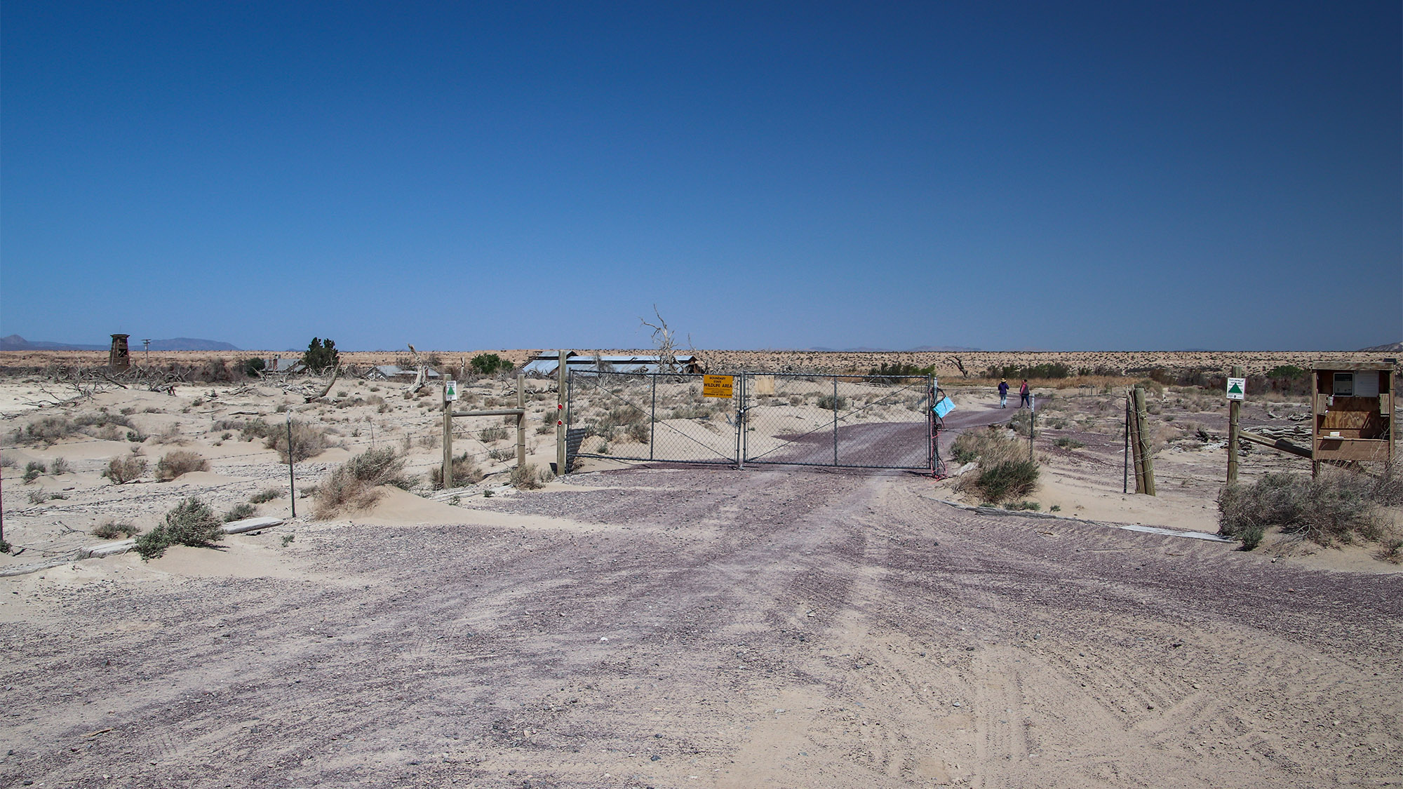
Today, Camp Cady is a wildlife area. It is open for hiking, birdwatching, camping, and small game hunting. The headquarters building is located among the old ranch buildings. Occasionally, there is a caretaker on-site. It’s interesting to walk around and see the old buildings.
Visiting Camp Cady
Camp Cady is reached from the pavement of Harvard Road. See the Getting There section on driving directions.
After parking your vehicle at the trailhead, walk through the gate and down the dirt road towards the buildings. In a few hundred feet, the trail makes a left turn towards the buildings. At this turn, on the right, you’ll find a pond that supposedly is used to raise endangered Mojave Tui Chub fish that is indigenous to marshes near the Mojave River.
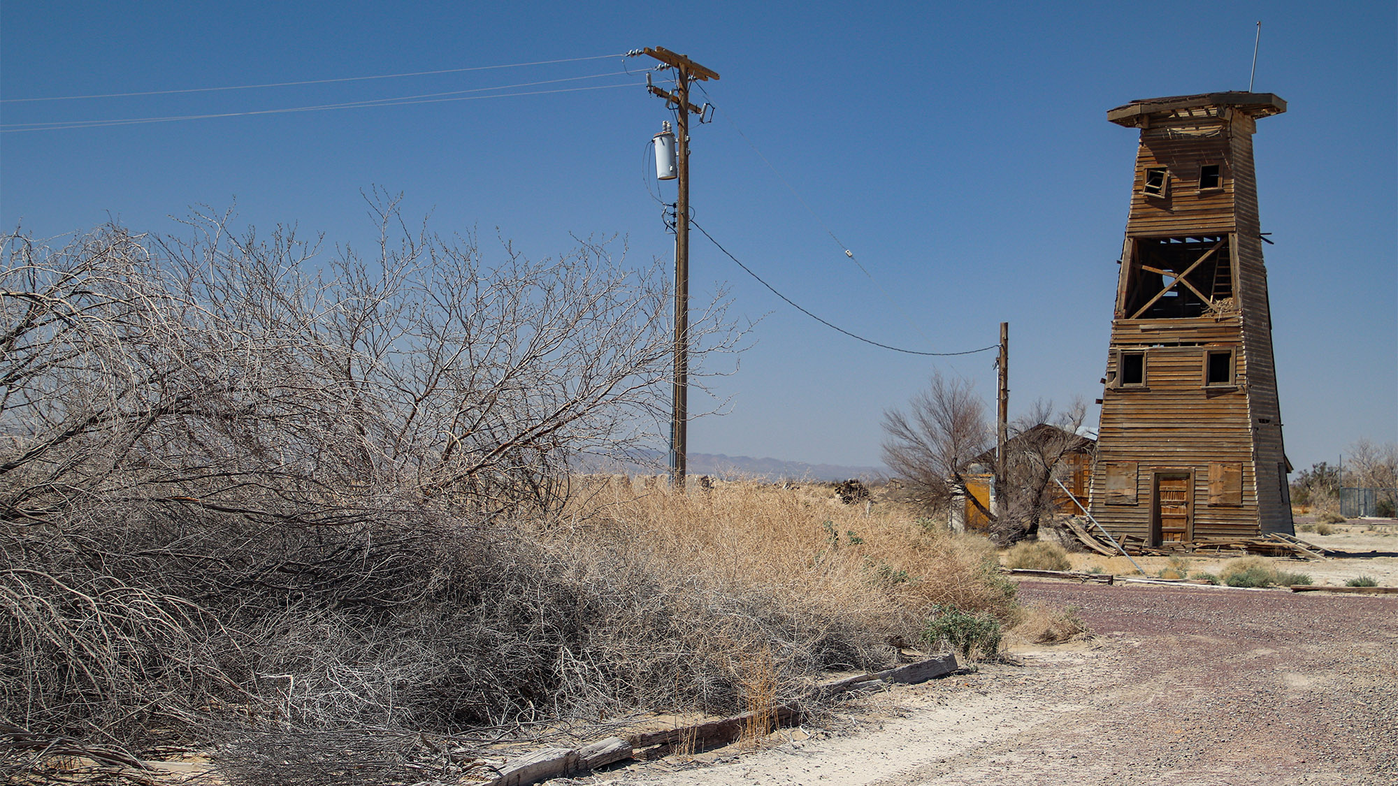
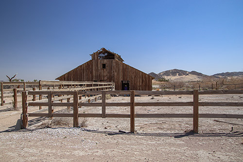
The first building on the right (after the pond) is the barn that was built in the 1930s. Past the barn is a residence which is where the caretaker(s) live. This was also most likely the main house for the 1930s era cattle ranch. Beyond the residence is an interesting wooden tower.
Walking past (north) the barn will lead into the main drainage of the Mojave River. Because of the presence of surface water around here, there is more vegetation along this section of the river and it was probably the reason for this site being selected for the redoubt in 1860. The site of the redoubt is down river (to the right or east) of the current-day Camp Cady about a half a mile. There are no remains of the redoubt visible.
See More of Camp Cady
Getting There
Getting to Camp Cady from I-40 does not include driving to it from the Fort Cady Road exit. Incidentally, this is the next off-ramp to the east from the Newberry Springs off-ramp on I-40. The pavement going north on Fort Cady Road from I-40 doesn’t go too far, as it quickly turns to sand. Faint traces of the road can be followed going north across the sandy desert terrain, and it does lead to the area near Camp Cady, however it isn’t advisable to use this road.
Instead, from Route 66, make your way to Newberry Road, turn north, and drive 6 miles (9.6 km) to Riverside Road. At the beginning, you’ll cross I-40 and the railroad tracks. At Riverside Road, turn right and continue for one mile (1.6 km), then turn left onto Harvard Road. In 0.8 mile (1.2 km), a well-graded dirt road heading northeast paralleling the riverbed will be found. This is the old Mojave Trail. You might find a sign marking the road as such. Take this road for 2.2 miles (3.5 km), then turn left to the trailhead. The trailhead is reached in few hundred feet.
Be careful with the dirt road. It often has soft sand and isn’t recommended for two-wheel drive sedans. The road is better handled with a four-wheel drive vehicle with off-road tires.
If you’re coming from I-15, drive south for 2.8 miles (4.5 km). Just after crossing the big dip going through the Mojave River, look for the dirt Mojave Trail explained above. Follow those directions to the trailhead.
